Eight U.S. East Coast cities are at high or very high risk of “extreme” flood damage based on current scenarios, with New York and New Orleans facing some of the greatest dangers, a new study finds.
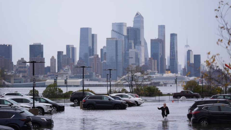
New York could see the highest number of people affected by flooding: 50% of New York City’s population — around 4.4 million people — and 47% of its buildings are currently at high risk of exposure to extreme flood damage if a major flood occurs, according to a flood risk assessment published Wednesday (April 22) in the journal Science Advances.
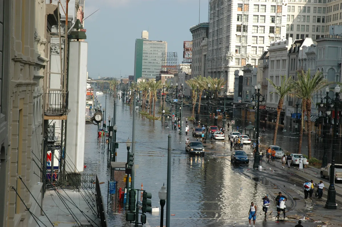
New Orleans faces the greatest relative risk, with 98% of its population — about 375,000 people — and 99% of its infrastructure at high risk of being exposed to extreme damage, according to the study.
The other six cities mentioned in the report are Houston; Miami; Norfolk, Virginia; Charleston, South Carolina; Jacksonville, Florida; and Mobile, Alabama.
The heightened threat and damage levels these cities face result from their low elevation, high population density, poor drainage, building height, rainfall and proximity to water. The study authors urged policymakers to work with local stakeholders to mitigate flood risk using nature-based solutions alongside structures like floodgates, levees and dikes.
“Such policies should restrict further urban development in high-risk zones while promoting the systematic incorporation of nature-based solutions,” the authors wrote.
Flood risk
Flooding is the most expensive natural disaster in the U.S., costing billions a year. By 2050, sea levels along the contiguous U.S. coastline are projected to rise by up to 1 foot (0.3 meters), and flooding following hurricanes is also increasing along the East Coast due to climate change.
With around 30% of counties along the U.S. Gulf and Atlantic coasts at high flood risk, it’s essential to understand which measures will prevent flood damage most effectively, the authors wrote in the study.
The researchers used machine learning to assess flood risk along the U.S. East Coast, using historical flood damage data from the Federal Emergency Management Agency. This data is of visual, bird’s-eye-view damage to properties associated with recent major flooding events, including Hurricane Isaac in 2012 and Hurricane Irma in 2017. The study classified properties that were fully destroyed as “extreme flood damage.”
The team then compiled data on 16 flood risk factors and developed a flood risk map, using these risk factors to predict exposure to flood damage The flood risk factors included natural hazards, such as distance from the water and elevation; exposure factors, such as population density; and the vulnerability of the population, such as the percentage of people living in poverty.
Based on these factors, the model produced a “flood risk index” of probability scores ranging from “very low” to “very high” risk. The coastal cities at the highest risk of floods leading to extreme flood damage could then be estimated. The team calculated the number of people and buildings that would be exposed to this damage.
The results showed that New York City and New Orleans share the “grim reality” of being “major flood-risk cities,” the authors wrote in the study. Almost 4.4 million people in New York City and over 215,000 buildings could face extreme flood damage. Over 98% of New Orleans’ population and buildings face similar damage.
Houston and Mobile, Alabama, are also at high risk of extreme flood damage, so, along with New York and New Orleans, these cities demand “prioritized attention from policy-makers,” the authors wrote in the study.
The authors noted several ways to potentially reduce flood damage. For example, parking lots built with impermeable concrete should be replaced with grass tiles to allow the soil to soak up the water, and wetlands and river floodplains should be restored and linked to drainage systems like gutters to support the fast removal of water from cities.